

COURTESY: CDRRMD - Oro Rescue
5:10 PM 17JULY2025
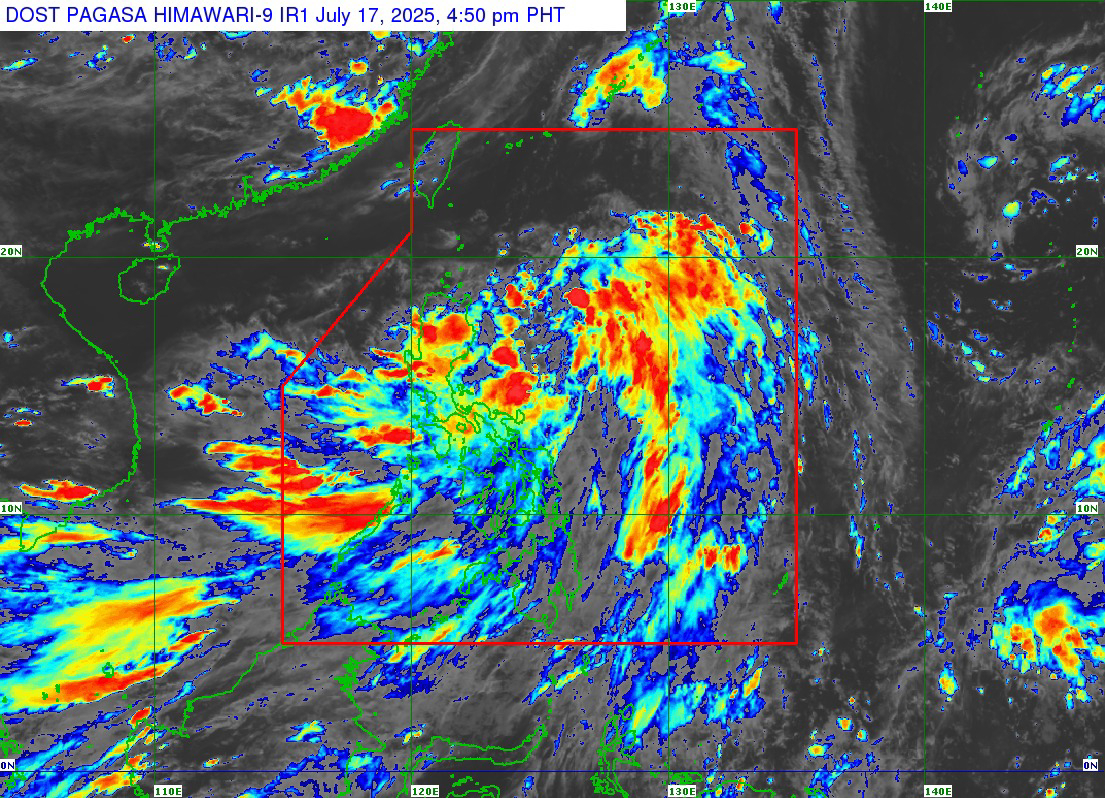
Based on PAGASA Weather Forecast as of 5:00 pm, the estimated Typhoon (Tropical Depression) “CRISING” within the Philippine Area of Responsibility (PAR), is located at a distance of 335 km Northeast of Virac, Cantanduanes; a strength of 55 kph; and a movement of 30 kph in the West Northwestward. The Storm is likely to push into Tropical Storn this Friday (July 18) morning.
Northern Mindanao is not affected by Typhoon but will experience cloudy skies accompanied by scattered rainstorms and thunderstorms due to Southwest Monsoon (South).
Forecast Position of TD "CRISING"
- Jul 18, 2025 02:00 AM - 265 km East of Casiguran, Aurora
- Jul 18, 2025 02:00 PM - 145 km East Northeast of Tuguegarao City, Cagayan
- Jul 19, 2025 02:00 AM - 65 km North Northwest of Laoag City, Ilocos Norte
- Jul 19, 2025 02:00 PM - 315 km West of Calayan, Cagayan
- Jul 20, 2025 02:00 AM - 490 km West of Calayan, Cagayan (OUTSIDE PAR)
- Jul 20, 2025 02:00 PM - 670 km West of Itbayat, Batanes (OUTSIDE PAR)
- Jul 21, 2025 02:00 PM - 1,015 km West of Extreme Northern Luzon (OUTSIDE PAR)
- Jul 22, 2025 02:00 PM - 1,250 km West Northwest of Northern Luzon (OUTSIDE PAR)
Moderate (moderate) to strong (strong) winds from Southwest (Southwest) to West (West) will result in 1.5 - 2.8 meters wave in Mindanao.
CDO is experiencing slow (light) rainfall right now.
Cloudy in Libona; Mampayag, Dahilayan and Lindaban, Manolo Fortich. (These areas are the source of water that floods the Lapasan to Bugo)
It's also cloudy in Talakag and Baungon. (These places can produce water in Cagayan river)
The water level of the rivers of Cagayan and Iponan is NORMAL.
CDRRMD stay on monitoring.


No comments:
Post a Comment